You must report your facility's latitude and longitude coordinates in decimal degrees.
- Be careful not to reverse your latitude and longitude coordinates.
- Enter only numerical data.
- Do not preface numbers with letters (such as N or W) to denote the hemisphere.
Here is an example of latitude and longitude values in decimal degrees:
Latitude = 38.898556
Longitude = -77.037852
- The latitude and longitude of the facility must be in decimal degrees with at least four decimal digits to the right of the decimal points (e.g., 32.9919, -96.7573.)

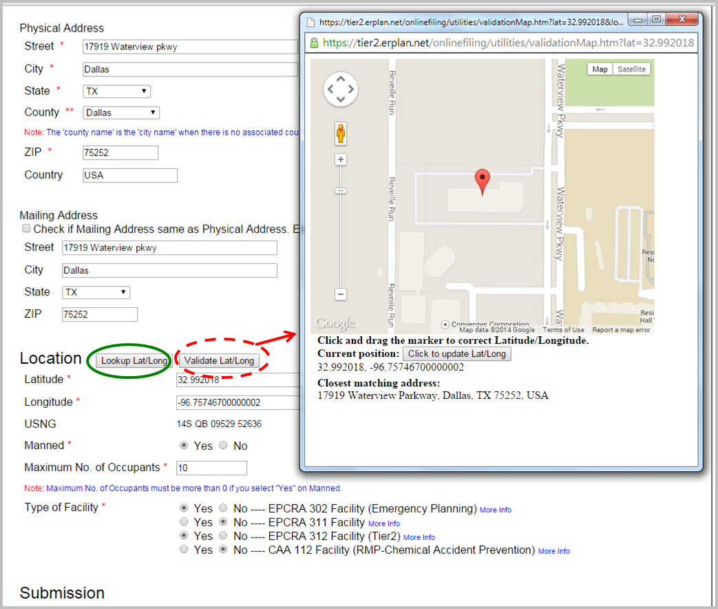
- Lookup Lat/Long button – If you do not know the latitude and longitude coordinates for your facility, you can select the "Lookup Lat/Long" button, and the system will convert your facility's physical address to latitude and longitude coordinates via geo-coding. If the reported physical address is incorrect, there is no mechanism for E-Plan to verify the geographical coordinates for that location is correct.

- Validate Lat/Long button When you click “Validate Lat/Long”, a Google map will display the coordinates of the initial point. You can drag the marker to a new location and then “Click to update Lat/Long”.
- Validation: The E-Plan system will check on every coordinate that is manually entered by you.
1) Check if a coordinate is in decimal degrees
2) For facilities located in the US (except Guam), check if the latitude coordinate is within the range of 0 to 80
3) For facilities located in the US (except Guam), check if the longitude coordinate is within the range of -180 to -50
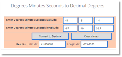
- If you know the latitude and longitude coordinates for your facility, but their values are in degrees/minutes/seconds (e.g., Latitude 40° 13′ 12.9″ N and Longitude 79° 45′ 25.2″ W). You must convert values from degrees/minutes/seconds to decimal degrees.
You can use this tool provided by the Federal Communications Commission to convert values from degrees/minutes/seconds to decimal degrees: https://www.fcc.gov/media/radio/dms-decimal.


